Appendix I
The Act to Found the Parish
From London Gazette 5/4/1852 (Italic comments in square brackets have been inserted in order to clarify some directions in the definition of the bounds in terms of modern names.)
" Church Building Acts " and of the nineteenth and twentieth sections of an Act, passed in the session of Parliament holden in the fourteenth and fifteenth years of Her Majesty's reign, intituled "An Act to amend the Church Building Acts” duly prepared and laid before Her Majesty in Council a representation, bearing date the ninth day of March one thousand eight hundred and fifty-two, in the words following viz.:
"Your Majesty's Commissioners for building new churches beg leave humbly to represent to your Majesty that the several parishes of Hughenden and Great Missenden, and an isolated portion of the parish of Stoke Mandeville, situated respectively in the county of Buckingham, and diocese of Oxford are contiguous to each other ; that the accommodation for attending divine service at the respective parish churches in the several parishes of Hughenden and Great Missenden is very inadequate for the aggregate amount of the population of such parishes, and the distance of the said isolated portion of the said parish of Stoke Mandeville from the remainder of the said parish renders it difficult for the inhabitants of such detached portion of the said parish to attend their parish church; that in the said parish of Hughenden there is besides the parish church, one church built in Polecat-lane at Prestwood, in the said parish, in or about the year one thousand eight hundred and forty-nine, which has been consecrated by the name of The Church of the Holy Trinity; that such church was built and endowed by public subscription, of which the Reverend Thomas Evetts, the present incumbent thereof, contributed two thousand five hundred pounds and upwards from his own private means; that the said new church of the Holy Trinity has been built near the extremity of the said parish of Hughenden, and near to a certain portion of the said parish of Great Missenden, and the said detached portion of the said parish of Stoke Mandeville respectively, and is situate at a considerable distance from the respective parish churches of the said three several parishes :
“That by an Act, made and passed in the session of Parliament holden in the fourteenth and fifteenth years of your Majesty's reign, intituled 'An Act to amend the Church Building Acts,' it is amongst other things enacted, that if the-major part in number of the patrons of the respective parishes out of which any consolidated chapelry is to be formed, by virtue of a certain Act passed in the session of Parliament holden in the eighth and ninth years of your Majesty's reign intituled 'An Act for the further amendment of the Church Building Acts,' or by virtue of the now reciting Act, concur as to the formation of such consolidated chapelry, and as to the body or person in whom the right of patronage to the church of such consolidated chapelry shall belong, the formation of such consolidated chapelry, and the vesting of the patronage of the church thereof accordingly, under the provisions of the said Act, or the now reciting Act, shall be as valid as if the patron of each such
respective parish had severally agreed to the same:
"That the Bight Honourable Benjamin Disraeli, of Hughenden Manor, in the county of Buckingham, M.P. is patron of the church of the said parish of Hughenden, and the Dean and Chapter of the cathedral church of the Blessed Virgin Mary of Lincoln, are the patrons of the church of the said parish of Stoke Mandeville, and Alderman Thomas Challis, the Reverend James Sherman, William Jackson Taylor, and certain other persons, acting as trustees for Cheshunt College, are the patrons of the church of the said parish of Great Missenden:
"That the said Benjamin Disraeli, as patron of the church of the said parish of Hughenden, and the said Dean and Chapter of the cathedral church of the Blessed Virgin Mary of Lincoln, as patrons of the church of the said parish of Stoke Mandeville, being the major part in number of the patrons of the said three parishes, have concurred as to the formation of the consolidated chapelry hereinafter recommended to your Majesty, and as to the person in whom the right of patronage to the said church shall belong, but the said Thomas Challis, James Sherman, William Jackson Taylor, and other, the persons as aforesaid, patrons of the church of the said parish of Great Missenden, have refused to concur therein :
"Your Majesty's said Commissioners beg leave further to represent to your Majesty that, having taken into cons ideration all the circumstances attending the said several parishes of Hughenden, Great Missenden, and Stoke Mandeville, it appears to them to be expedient that certain contiguous parts of the said three several parishes should be united together into one consolidated chapelry for, and to be assigned to, the said new church at Polecat-lane, Prestwood, called ‘The Church of the Holy Trinity', with respect to all ecclesiastical purposes, under the provisions of the ninth section of the said Act, passed in the session of Parliament holden in the eighth and ninth years of your Majesty’s reign, intituled 'An Act for the further amendment of the Church Building Acts,' and of the nineteenth and twentieth sections of the said recited Act, passed in the session of Parliament holden in the fourteenth and fifteenth years of your Majesty's reign, intituled 'An Act to amend the Church Building Acts’; and that such district so to be united should be named “The Consolidated Chapelry of Prestwood” with boundaries as follows, that is to say; to commence at the junction with Moat-Lane of the road in the parish of Stoke Mandeville leading from Kiln Common in a direction nearly north-east to Moat-lane [ie Greenlands Lane], and proceed two furlongs and twentytwo yards, along the fence on the east side of Moat-Lane in a direction nearly south-east (and include the piece of waste land in the parish of Great Missenden on the east side of Moat-lane [ie the chalk-pit], and also the gardens belonging respectively to Samuel Ives, Isaac Aldridge, and Jabez Wright, encroached from such waste and the pond there [Wibner Pond]), unto the field of the devisees of the late Earl of Buckinghamshire [ ie Moat Farm ], which is on the south of the said garden of the said Jabez Wright; thence in an easterly direction eighty-eight yards along the hedge on the north side of such field, and one hundred and fifty-four yards in a direction nearly south along the hedge on the east side of such field and the field adjoining it on the south, unto the junction of such last-mentioned field (which is also the property of the said devisees of the said late earl), with the north corner of a field belonging to Mr. George Cross [ie Further Meadow] thence sixty-six yards in a southeastwardly direction, and one hundred and fifty-four yards in a direction nearly east along the fence separating the above-mentioned field, belonging to the said George Cross, and two other adjoining fields, also belonging to the said George Cross, from land belonging to the devisees of the said late earl, to the hedge on the north-west side of land belonging to Mr. James Oliff; thence ninety-nine yards in a direction nearly north-east along the hedge which separates such last-mentioned field from the land of the said devisees of the said late earl; thence one furlong in a direction south-east along the hedge which separates the said field of the said James Oliff and the two adjoining fields, also belonging to the said James Oliff, from the land of Mr. Thomas Furnivall, unto the termination of such hedge; thence seventy-seven yards in a direction nearly southward along the hedge on the east side of the said fields, belonging to the said James Oliff, to, and thence ninety-nine yards in a direction nearly east along, a hedge separating two fields, both the property of the said Thomas Furnivall, to a lane called Blind-lane; thence two hundred and nine yards in a southward direction along such lane, called Blind-lane [ track and public footpath off Moat Lane past Prestwood Common Farm ], to Prestwood Common [ie the farm of that name]; thence ninety-nine yards in a direction nearly south-east, along the north-east side of such common, to the land belonging to Mr. William Crouch; thence one hundred and forty-three yards in a direction nearly east, along the fence separating the land belonging to Mr. Joseph Honnor from the said land and the premises belonging to the said William Crouch; thence eighty-eight yards from the north-east corner of the said land belonging to the said William Crouch, and in the same, or nearly the same, direction along the backs of the row of houses belonging to Mr. James Nash [the Green Man row], to the gate at the junction of Martin's End-lane with Prestwood Common [now the junction with Green Lane]; thence one hundred and eighty-seven yards along the east side of that part of Prestwood Common called Town Stile, in a southwardly direction, to the junction of the parish road leading past Anlow's Farm homestead, belonging to Mr. Joseph Honnor, with Green-lane; thence three furlongs and one hundred and thirty-two yards along such parish road, in an easterly direction, close to, but on the north side of, the homestead of such farm, to the hedge separating fields belonging to Mr. Thomas Stevens, and which hedge is two hundred and nine yards beyond the extremity next such parish road of the land belonging to Anlow's Farm, on the south side of such road; thence in a southwardly direction and in nearly a straight line one furlong and one hundred and forty-three yards along such last-mentioned hedge, and along the hedge on the east side of a wood, called Atkin's Wood, late the property of the late Mr. Thomas Ives, but now of Miss Ann Daniel, to a lane called Hobb's-Hill-lane; thence one hundred and twentyone yards in a south-westwardly direction, and three furlongs and eighty-eight yards in a southwardly direction along such lane to Prestwood Common [ie to junction wuith Nags Head Lane] ; thence in a south-westwardly direction one hundred and forty-three yards along the south-east side of Prestwood Common to the homestead of Neardwood Farm; thence in a direction south-east thirtythree yards, south-west sixteen yards, north-west sixteen yards, south-west one hundred and thirtytwo yards, and north-west twenty-two yards, so as to include Neardwood Farm homestead and garden to Prestwood Common [Peterley Lane]; thence in a southwest direction one furlong and thirty-three yards along the south-east side of such common [ ie along Peterley Lane ], and along the road leading from such common past Peterley House, to the part of such road opposite the entrance gates to Peterley House; thence in a south-eastwardly direction four furlongs along the road opposite Peterley House [ie Peterley Avenue], to and leading from such last-mentioned road, along the fields, to its junction with the road leading from Wycombe Heath to Little Kingshill Heath End Road]; thence four furlongs and two hundred and ten yards along such last-mentioned road in a south-westwardly direction, and along the north-west side of the part of Wycombe Heath in the parish of Great Missenden, and including the house and orchard of Mr. James Nash, on Wycombe Heath, opposite the White Horse Public-house there, to Cockpit Hole; thence westward one furlong and one hundred and fifty-four yards along the road on the north side of the pond at Cockpit Hole, to Great Kingshill Common [Stag Lane], and from the junction of such last-mentioned road with such last-mentioned common, in a south-west direction, and in a straight line, two furlongs and one hundred and thirty-two yards diagonally across such common, and passing to the south-east side of a pond on the south-west side of such last-mentioned common, to a hedge on the south-east side of a meadow belonging to Mr. William Nash; thence south-westward one hundred and four yards along such hedge to the other side of such meadow; thence one hundred and ten yards north-westward along the hedge on the south-west side of such meadow, to a piece of land belonging to Martin Janes; thence westward, or nearly westward, eighty-eight yards along the hedge on the south side of such last-mentioned prece of hind to the end thereof; thence in nearly a straight line eightyeight yards, nearly northward along the hedge on the west side of such last-mentioned piece of land and a piece of land adjoining such last-mentioned piece of land on the north, also belonging to the said Martin Janes, and across land now or late belonging to Richard Tilbury, and along the hedge at the west end of a piece of land belonging to Mr. Richard Janes to the lane there leading from Great Kingshill Common aforesaid to Piper's Corner Farm; thence in a north-eastwardly direction thirty-three yards along such lane to Great Kingshill Common aforesaid, and sixty yards along the north-west side of such common to the south corner of a field adjoining such common, belonging to John Staples, Esquire; thence in a north-west direction one hundred and four yards along the hedge on the south-west, and in a north-eastwardly direction two hundred and nine yards along the hedge on the north-west side of such field and other land adjoining, also belonging to the said John Staples, to a lane there called Hatches-lane; thence one hundred and fiftyfour yards along such lane north-westward to the south-west corner of a meadow belonging to the farm called Hatches Farm, the property of the said devisees of the said late earl; thence in a direction nearly north-east ninety-nine yards along the hedge on the north-west side of such meadow to a field adjoining thereto, and also belonging to the said farm; thence north-westward one hundred and ten yards along the hedge on part of the southwest side of such last-mentioned adjoining field, and north-east one hundred and seventy- six yards along the hedge on the north-west side of the same field, and passing part of the west end of the land belonging to the Wycombe poor, to the land belonging to Fry's Farm [now Cherry Tree Farm], the property of Francis Sewell Cole, Esquire; thence four furlongs and one hundred arid sixty-five yards along the south and west boundary of such farm, called Fry's Farm, and the plantation and woodland [ie Longfield Wood] belonging thereto, to the road leading from Chipping Wycombe to Great Hampden [ Hampden Road ]; thence one hundred and four yards along such last-mentioned road northward to the boundary fence between the Farm called the Warren Farm, the property of Thomas Tyrwhitt Drake, Esquire, and the farm called New House Farm, late the property of the late Mr. Thomas Ives, joining such road [ this is where the private road Dennerhill Lane joins Hampden Road by Denner Lodge ] ; thence four furlongs in a westwardly direction along such last-mentioned boundary fence to the part where such boundary fence joins the lane leading from such last-mentioned road to Bryant's Bottom; thence nearly northward one mile and sixty-six yards along such lane [Bryants Bottom Road], and along the hedge on the west side of Denner Hill Common, to the extremity of the parish of Hughenden there [ where the path continuing west from the top of Rolls Lane meets the Bryants Bottom Road ]; thence first eastward, then northward, and then north-eastward, by the boundary lines between the parishes of Hughenden and Monks Risborough, and Hughenden and Great Hampden, and Great Missenden and Great Hampden, to the west corner of the before-mentioned detached part of the parish of Stoke Mandeville, a distance of one mile, five furlongs, and twenty-two yards [ ie to Honor End Lane just south of Honor End Farm ]; and thence along the northwest, north, and east sides of the said detached part of the said parish of Stoke Mandeville to the said commencement thereof at the said junction of the said road from Kiln Common with Moatlane, a distance of seven furlongs and forty-four yards, including the whole of such detached part of the said parish of Stoke Mandeville; and which said boundary is in its aggregate length nine miles, six furlongs, and one hundred and ninetysix yards, little more or less; which proposed consolidated chapelry is delineated on the map or plan hereunto annexed, and is therein tinted yellow, pink, and blue.
"Your Majesty's said Commissioners beg leave further to represent to your Majesty, that having taken into consideration all the circumstances attending the said three parishes of Hughenden, Great Missenden, and Stoke Mandeville, and having regard to the large amount contributed by the said Thomas Evetts from his own private means towards the erection and endowment of the said church, it appears to them to be expedient that the right of presentation and appointment of a minister to serve the said church of the Holy Trinity being the church of such consolidated chapelry, shall for ever hereafter belong to, and when occasion shall require, be exercised by, the said Thomas Evetts (the present minister or incumbent of the said new church, called the church of the Holy Trinity), his heirs and assigns.
"That the consent of the Right Reverend Samuel, Lord Bishop of Oxford (in whose diocese the said three several parishes of Hughenden, Great Missenden, and Stoke Mandeville, are respectively situate) and also the consents of the said Benjamin Disraeli (the patron of the church of the said parish of Hughenden) and of the said Dean and Chapter of the cathedral church of the Blessed Virgin Mary, of Lincoln (the patrons of
the church of the said parish of Stoke Mandeville), have respectively been obtained to the formation of the said consolidated chapelry, and to the right of presentation and appointment to the said new church of the Holy Trinity being vested in the said Thomas Evetts, his heirs and assigns, as is required by the said Acts, in testimony whereof the said Lord Bishop and the said Benjamin Disraeli have respectively signed and sealed this
present instrument, and the said Dean and Chapter have affixed their common seal hereto.
"Your Majesty's Commissioners therefore humbly pray that your Majesty will be graciously pleased to take the premises into your royal consideration, and to make such Order in respect thereto as to your Majesty, in your royal wisdom, shall seem meet."
Her Majesty, having taken the said representation, together with the map or plan thereunto annexed, into consideration, was pleased, by and with the advice of Her Privy Council, to approve thereof, and to order, as it is hereby ordered, that the proposed consolidation and assignment be accordingly made, and the recommendation of the said Commissioners, in respect of the right of presentation and appointment of a minister to serve the said church of the Holy Trinity at Prestwood, can be led into effect, agreeably to the provisions of the said Acts; and Her Majesty, by and with the like advice, is pleased to direct that this Order be forthwith registered by the Registrar of the diocese of Oxford, Wm. L. Bathunt.
APPENDIX II
The Making of the Parish Map
… let everyone begin with his own parish, and till that area intensively.
Walter Johnson, introduction to 1931 edition of Gilbert White’s Journals
Why did we need a parish map? It is not just a street map. It is more even than the excellent Ordnance Survey maps, the envy of other countries for their precise and detailed recording of the buildings, basic land features and contours, the essential vade-mecum of every traveller. It is more because it is created by local people, showing the things that are significant to them. It is more because it is a thing of art and celebration in itself, something to treasure as a point of local reference for years to come. It belongs to, and is a symbol of, a living community. More prosaically, it also provides more information than any official map – where the old hedgerows have survived, where examples of the sarsen- and pudding-stones can be seen, where the oldest trees are, the old names, agricultural land-use, and so on. It is also a map that moves through time, recording not only the present but also how it has evolved out of the past.
The Prestwood Society committee considered my suggestion of our own parish map in 1995 and was enthusiastic about it. A small sub-committee was formed to help me take it forward and we began work in 1996. We advertised the project locally with leaflets and through the proceedings of the Prestwood Society itself. We made contacts with local organisations that could help. I attended a meeting organised by the then Bucks Council for Voluntary Service (now Bucks Community Action) to promote the idea of local maps, where I was able to share the experiences of those who had gone before, as well as seeing examples of what they had produced.
This provided a great deal of useful information – not least that we needed to formulate our own idea of what it would look like, what form it should take, not copy any predecessors, for each had done it in their own way to suit local exigencies and preferences. Moreover, most prior examples were of maps of small villages or compact urban areas – the population and size of the Prestwood parish meant that ours was a particularly ambitious undertaking. For instance, for a long time we stuck by the idea that we should show every single house and building, as most village maps we had seen had done. It was important, we thought, that every resident should be able to identify their own little spot on the map. My early drafts followed this intention, but it eventually became evident that, at the feasible scale of such a map, the attempt to show several thousand houses would have made the map much too dense and complex, taking away from the vision of the area as a whole.
In the end, apart from historically or architecturally important buildings, larger houses standing alone, and certain commercial and public properties, we decided to represent the main areas of residence by uniform blocks of colour along the numerous streets and roads, which enabled the latter to stand out much more clearly and helpfully. I was sad at this loss, but apart from the look of the thing, it would have meant an incredible increase in the amount of surveying, for the lines of property boundaries on extant Ordnance Survey maps were well out of date for large parts of the district. The biggest loss, perhaps, was not being able to show that these patches of brown on the map do not just represent buildings, but an even larger area of garden which is an important and special habitat for wildlife (especially birds) and certain flora (including so-called “weeds”!). It is far from a concrete wasteland, but vibrant with a life of its own. Apart from the fact of not being able to record gardens, however, it could be argued that the uniform representation of the built-up area was more congruent with that of the rest of the countryside, also coloured field by field according to usage (pasture, arable, “wasteland” etc), without any attempt to mark every individual tree, with the exception of those of particular interest or antiquity. Why should we assume that we as human beings are more significant than each plant or animal with whom we are privileged to share this space we call home?
These, then, were the sort of decisions we had to take at the outset or as we proceeded with the project. We could, for instance, have opted for an impressionistic, subjective portrait of the area, as several admirable village maps have done. We always intended, however, that our map would not just be a representation, but that it should convey information and provide a basis for future planning. The size of the area contributed to this, but it was a conscious decision in any case. I think that the feedback we got from visitors to the map when it was finally put on display confirms the correctness of that decision – one of the things that is most remarked upon is the wealth of information that invites people to study it in detail and learn fascinating facts about their own part of the parish they had never realised before: it draws people in and makes them feel they are part of an organic experience comparable to walking the by-ways of the parish themselves.
There is only so much information, however, that can be crammed into one map. This is why we opted for one large central map showing the contemporary parish at a scale of 1:5,000 (twice the scale of the Ordnance Survey walking maps), framed by two side panels containing small maps of specific features that could not be shown adequately or clearly on the main map. Given that the parish is roughly diamond-shaped (a rather ragged diamond!), the central panel was left with considerable blank areas where artwork could be inserted, illustrating the wildlife, buildings and scenery of the parish. One of the side panels was devoted to the time dimension, smaller-scale maps reconstructing the parish at fifty-year intervals from 1850. The other side panel was used for four similar maps showing the geology, contours, natural habitats and footpaths. The natural habitats and footpaths are shown on the main map as well, but the simplified side maps help to focus attention on these features. The contours map is essentially a poor substitute for having a three-dimensional map! It is one of my regrets that we could not really combine a detailed “plan” of the area with an impression of the dramatic topology of the region with its steep-sided valleys in the western part. Map-making, we have learned, is a matter of trade-offs between maximum information, clarity and practicality. We had our cake and ate it, in this case, by baking nine different cakes!
Having set out our objectives it remained to draw up the maps. For the main map Ordnance Survey maps were a starting-point, but were out of date and omitted much of the information we wanted to include. I therefore undertook to walk the whole parish (many times) to re-survey the area and identify the additional features we wanted. I did this by drawing up an outline map at half the final scale, using OS maps as a basis, and then correcting these and adding in information as I went around. Having completed the whole area in about two years (1996-97) I was ready to draw up the first completely new drafts to scale. Given the size of the final map (70cm x 90cm), I drew it up for convenience in nine separate A4 sections, both easier to manage on an ordinary desk-top and to take out for checking in the field. At this stage it became obvious that I had missed some things, had imperfect or inaccurate information about others, or could no longer interpret some of my markings crowded on to an inadequately-sized pro forma. It would have to be surveyed again! This time, however, the process was greatly speeded up by three factors. One was having at hand the larger-scale sectional maps, making additions and corrections much easier to do – most of it was reasonably accurate! The second was that I recruited my wife Val and another resident, Max Watters (a trained surveyor), to help with the re-survey. Finally, I decided to take early retirement, so that I was no longer limited to the number of leave-days I could salvage from holidays and waiting in for washing-machine repairers. (The urgency to complete the map was, I should add, only one factor among several others in the decision to retire!)
At this stage, too, Val and I undertook a number of special surveys of particular features. I had already for some years (even before the conception of the map) been surveying the flora and wildlife of the area, and I completed this by visiting the remaining woods and other habitats for which I had insufficient records. We also dated most of the hedgerows (see Appendix III). Finally, we measured the girths of all the larger trees to which we could gain access, so that we could again make some estimation of their ages and plot the oldest ones on the map (see Chapter 12).
I finally drew up, in Indian ink and by hand, a full-scale final draft of the map, coloured with felt-tips, at the beginning of 1999. This had to be copied carefully, in black and white, again by hand, for the final map itself, which was then handed on to Anne Bowring for painting. I was then able to complete the eight panel maps, each similarly in two versions, one in colour as a guide, and the other in black and white for Anne to add the paintwork. We used a thick art-grade paper whose surface was not too smooth and was off-white, in order to avoid a glaring contrast between the background and the painted areas.
The small inscriptions on the maps were carried out by myself, with not too much skill it must be said, but I was able to write when necessary at a very small size to fit the often restricted space available. For the larger inscriptions, especially the longer texts that sit beside the panel maps, we recruited Judi Precious to create these in her beautiful old script, familiar to any local resident who has seen her notices around the church and elsewhere. They were done on separate pieces of the same art-paper used for the map.
The illustrative artwork had also been prepared, on thicker painting paper, as separate items. Painted by local artists, they include some of the notable architectural features of the parish, along with a variety of scenes, birds and flowers. The number of potential subjects with some significance for the local area was much larger than could possibly have been incorporated. The final selection was bound to be haphazard at best, so the choice of subjects was left to the artists themselves, giving them the freedom to portray whatever inspired them at the time. This policy obviously paid dividends in the quality of work submitted, every piece of which was used in the final display.
By September 1999 all these elements were ready for assemblage. We took the precaution of having each one photographed at this stage, because once under glass and mounted as a whole it would not be possible to do so. The different sections were taken to the workshop of the Art Shop in High Wycombe, where we spread them all out together for the first time and decided upon the final layout. The staff there helped to mount each of the sections on white board by heat-sealing. Finally, it was complete, a huge five feet by eight! It only remained for the Art Shop to frame and mount the central panel and the two side panels.
A public ceremony was held to mark the uncovering of the map on Saturday, 30th October 1999, after it had been mounted on a wall of one room in the Prestwood Village Hall the previous weekend. Many people, including county and district councillors, crowded in to hear the brief speeches by Keith Davies (Chair of the Prestwood Society), Desmond Keen (local historian and an inspiration), Nobby Clarke (representing the Great Missenden Parish Council that had funded the mounting of the map), and myself. Press were present from the Bucks Examiner, whose report began:
Prestwood is put on the map
The Prestwood parish map was unveiled in all its splendour on Saturday at the village hall.
The map, which is the brainchild of the Prestwood Society, is an impressive piece of work, studded with line drawings and other attractive illustrations, including paintings of familiar landmarks. The chart also boasts a fascinating range of details, including ancient hedgerows.
Bucks Examiner, Friday, November 5, 1999
The map remains in the village hall to this day, freely available to any visitor.
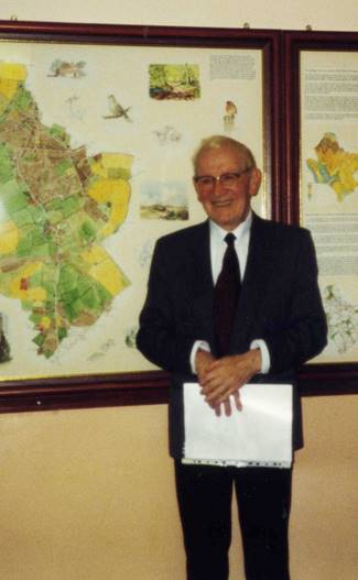
Local historian Desmond Keen at the unveiling of the Parish Map
Appendix III
Evidence from Hedge-dating
Evidence for early settlement is sparse in surviving documents but there is a source in the landscape itself – the hedgerows. Research has shown (Hopper 1974) that the age of hedgerows is correlated with the number of woody species they contain in a 30 metre length. This can be used to estimate the age of existing hedgerows. By looking at where the oldest ones occur, one can speculate on the nature of settlement in the parish in medieval and even pre-medieval times. Details of the survey are given in a later chapter, but the results showed 29 hedges that probably dated back to early medieval times and 8 whose origin likely goes back to Saxon times, before the Norman conquest.
The eight oldest hedges consisted of
(a) three sections of hedge alongside the main Wycombe Road close to Peterley crossroads, from the Polecat to the southern end of Peterley Corner Farm;
(b) two sections of hedge along Hobbshill Lane;
(c) the northern section of Greenlands Lane towards Hotley Bottom Farm;
(d) field hedges going north from Nanfan Wood;
(e) along Pipers Lane by Limmers Mead.
The first four of these bound ancient trackways and probably indicate that these routes had already been established in Saxon times, which also means that there was probably some occupation of the area in their vicinity as long ago as that. The fourth is a hedge that once marked part of the boundary of Great Kingshill Common, which again makes it likely that there was at least one farm at Great Kingshill before William the Conqueror (more or less where the present Hatches Farm is situated).
Not every section of hedge along Wycombe Road, Hobbshill Lane and Greenlands Lane scored as highly as the above. This is because some have been wholly or partially destroyed by development, or because they have been neglected. In this way we may have lost some indicators of ancient boundaries altogether. Those that do survive should really be seen as ancient monuments and given full protection.
If we go on to look at the whereabouts of the next highest category of hedge, we the picture tends to become clearer. These hedges include further sections of hedge along Hobbshill Lane, Wycombe Road and Greenlands Lane, confirming their ancient origin. They also include hedges along the track to Andlows Farm from the west, Honor End Lane, Rolls Lane, the road to Dennerhill Farm at the north end of Denner Hill, Hangings Lane, and Hampden Road as far north as the junction with Rolls Lane. This implies that the basic structure of roads that we see on the 1850 map of Prestwood was already in existence in medieval times, perhaps with the exception of Hangings Lane, as the hedges along here may be survivors from the woodland that previously bordered it, making the usual method of dating unreliable. The only other hedges with similar scores form a little cluster at Kiln Close and by Ladyboys in the centre of the original Prestwood hamlet. Their scores are enhanced by fruit trees of domestic origin, reflecting their propinquity to orchards flourishing here until the mid-C20th, which again makes their scores unreliable as age indicators (although Ladyboys does date back to the early C15th at least) and a large part of these two hedges did not exist even as late as 1850.
The rest of the older hedges are all field hedges (or former field hedges). Their location may give some indication as to where the earliest farming settlements were. Again there are a considerable number of high-scoring hedges beside the fields north of Nanfan Wood. This includes a very long stretch of hedgerow from Nanfan Grange to the wood following the old boundary between Hughenden and Missenden (since moved to the other side of Nanfan Wood). This area of old hedgerows encompasses Hangings Lane and it appears that a farm running south from Nanfans may have been one of the earliest settlements in the area. To the east of this patch of larger fields there is one of narrow strip fields behind the old houses that fronted on to Prestwood Common, at the north end of what is now Wycombe Road. A couple of hedges near Mill House score highly, but unfortunately many of the others have been poorly managed or affected by garden operations and many gaps now occur. The form of these fields, however, is a possible sign of Anglo-Saxon crofts. Similar small fields show on the 1850 map off Greenlands Lane and north of Hatches Farm at Great Kingshill.
Another cluster of high-scoring field boundary hedges occurs either side of the Wycombe Road close to Peterley Corner, probably associated with another farm settlement corresponding to Nives Farm. Other old hedges are scattered. They include another long stretch on the eastern side of the crest of Denner Hill, again confirming the existence of a settlement there from very early times. The southern boundary of the old Prestwood Common is also marked by another long line of old hedge, now backing the new development along Lodge Lane. This would not only confirm the early existence of the Common, but also of enclosed fields to the south of it, possibly part of the Missenden Abbey Peterley Estate (see below). There are just two other sections of hedge, both old field boundaries, that might date back to the medieval period. One is at the bottom end of Perks Lane and the other beside a small lane off Stag Lane. These are both very recent lanes, which post-date the hedges, and therefore indicate old field boundaries.
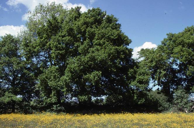
Ancient hedge running between Nanfans and Nanfan Wood